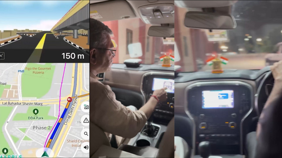
Union Minister Ashwini Vaishnaw Praises Indian Map App Mappls; MapmyIndia Gratefully Responds, 'Thank You for Your Kind Words' (Image Source: Screengrab from the official X handle of @AshwiniVaishnaw)
Tech News: After launching India’s WhatsApp alternative Arattai, another Indian app Mappls is now making headlines as a strong competitor to Google Maps. Union IT and Railways Minister Ashwini Vaishnaw recently shared a video on X praising Mappls’ features, which led to a 10.7 per cent rise in the shares of its parent company CE Info Systems. He highlighted that the app offers 3D junction views, guides users to specific shops in multi-floor buildings, and encouraged everyone to try it out.
Swadeshi ‘Mappls’ by MapmyIndia 🇮🇳
Good features…must try! pic.twitter.com/bZOPgvrCxW— Ashwini Vaishnaw (@AshwiniVaishnaw) October 11, 2025
Ashwini Vaishnaw also revealed that the Indian Railways will soon sign an MoU with Mappls, enabling the use of its advanced features across railway services. MapmyIndia is an Indian company owned by CE Info Systems. In the video, Vaishnaw was seen using MapmyIndia through Apple CarPlay, demonstrating its capabilities. The app offers real-time navigation, similar to Google Maps.
Many users on X have suggested integrating MapmyIndia into Arattai, the Indian-made WhatsApp alternative. In response, Rohan Verma, Director of MapmyIndia, posted that he too supports the idea of integrating Mappls into Arattai. He mentioned that any app developer can integrate Mappls using its API and SDK, and even shared a link explaining how to do so.
CE Info Systems, the parent company of MapmyIndia and Mappls, develops location-based IoT products and platforms. According to the company, Mappls is specially designed for India, allowing users to search for locations and addresses even at a very local level—from streets and neighborhoods to villages. It also features a unique “Mappls Pin” system, inspired by Google Map Pins, which allows easy sharing of accurate locations.
Designed for Indian Roads: Includes details like speed breakers, potholes, tolls, roadblocks, and local lane names.
RealView: Offers 360° photos of notable places in India.
Language Options: Available in Hindi and other Indian languages.
Safety Alerts: Provides road safety alerts, weather updates, and air quality information.
Offline Maps: Navigation works without the internet after downloading offline maps.
Privacy: All user data is stored securely within India.


Copyright © 2025 Top Indian News
